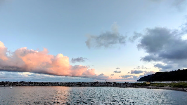
Silva Bay, Gabriola Island, BC
When crossing from Vancouver Island to Vancouver, the city, on the mainland, the decision on which route to take is an important one. This is for several reasons.
First the geography of the area. The west coast of Vancouver Island is pleased with a densely packed collection of islands. Second is the seas water which must move around these islands as the tide cycles between low and high. This change is large at around 14 feet, but can be even higher under certain conditions. As large volumes of water must move through narrow passages, it must move quickly. The movement can often be violent accompanied by aggressive swirling that mimics whirlpools and is easily capable of capturing and spinning a boat if passage is attempted when currents are at their max. A much safer tactic is to transit these areas at slack water. This is the time when the current pauses as it prepares to move in the opposite direction due to the tide change.
We had the following passes from which to choose as we planned our exit from the Gulf Islands to Vancouver.
- Dodd Narrows
- Gabriola Pass
- Porlier Pass
- Active Pass
Moving a vessel through any of these passes is further complicated by the fact that the pass itself will twist and curve with addition of miscellaneous rocks and reefs that must be avoided during transit. As mentioned earlier, the passes are narrow, so ships are urged to make call on VHF radio announcing they are entering the pass, and their direction of travel, to avoid problems with passing other vessels in the narrow channels.
So needless to say, the pucker factor is as least moderate, It is not unusual to see boats gather on the two sides of a pass to wait for conditions to their liking. Finally, a brave sole will make the radio call and proceed through. This starts the dash to get through prior to the currents building to too high a velocity.
The final factor in the equation is the direction of the wind. You can vary your direction of travel by which pass you choose. In particular, the direction of the wind relative to your direction of travel. You want to choose wisely so you don't have waves on your side. This would cause the boat to roll uncomfortably from side to side. If tide and wind are moving in opposite directions, you will have wind waves which can be higher if the difference in velocity is large. If both wind and current are moving in the same direction, and are behind you, you will have the smoothest ride.
So a lot of thought must go into the decision of where to start your passage across the Straits of
Georgia.
We observed other vessels transiting Gabriola Pass prior to going through ourselves.
Here we see a trawler moving through the pass at slack water, carefully avoiding underwater rocks and reefs.
Our decision after looking at all the available information on tides, wind, and weather was to transit Gabriola Pass and head east to Vancouver. This is also the shortest route. We departed Montague Harbor to time our arrival at the pass to coincide with slack water.
Silva Bay is an inlet on the south east side of Gabriola Island. We spent one night there. This gave us time to hike to a nearby Provincial Park. In the evening we played card games. Twilight lasts beyond 10:30pm and it is rising by 5:15am. We haven't stayed up long enough to see when it gets fully dark.
The next day we departed, mid-morning, for the ~28 mile passage to False Creek in Vancouver.
We stayed at Page's Resort and Marina
Pages Resort was clean with Rental Cabins and a Campground
An old gas pump in front of the store
The onsite cabins had nice views
A group of Kayakers in the campground
The picnic area at Pages Resort
A starfish along the shore
Walking to Drumbeg Provincial Park
A local art installation
Additional local art
The shoreline in Drumbeg Provincial Park
Lots of logs on shore. These can float off on a high tide.
You must watch constantly for logs in the water.
We found a school that taught the art of constructing timber and log houses.
This structure was built without traditional fasteners.
Pegs were used to connect the timbers.
If you are interested, here is the contact information for the school
Looking east towards Vancouver


Comments
Post a Comment