Posts

Showing posts with the label planning

Boating British Columbia - Weather, Tides & Currents

Image
Weather Marine Weather for Strait of Georgia Basin Lightstation Weather Reports-British Columbia Decode Information for Lightstation Reports Halibut Bank Weatherstation (Buoy) Check Lighthouse and Station Reports from Chrome Island, Merry Island,  Entrance Island, Halibut Banks & Sentry Shoals Chrome Island Lighthouse  is located near Deep Bay, British Columbia. It has been in operation since 1891 and assists maritime traffic in the region around Denman Island and Hornby Island. Merry Island Lighthouse  is situated on Merry Island, which is part of the Sunshine Coast in British Columbia.  Entrance Island Lighthouse  is located on Entrance Island, which lies off the North-East corner of Gabriola Island.  US Weather Service Buoys Buoys - Pacific Coast Sentry Shoals ,  station 46131 Halibut Banks , station 46146 Southern Georgia Straits , station 46303 Friday Harbor , station FRWW1 Check status of Whisky Golf military area - Continuous Marine Br...
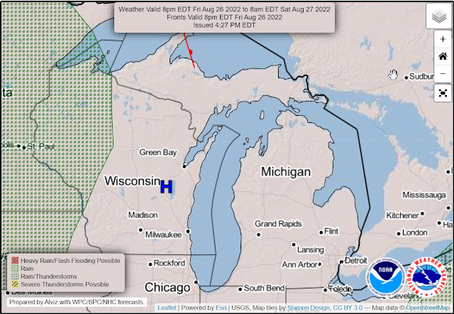
Great Loop: Lake Michigan Weather Resources

Image
Lake Michigan Weather Resources I built this page to give better access to weather resources for planning our boating trip south, down the east side of Lake Michigan. Seagull :  Great Lakes Observation System Wind Speed - Lake Michigan North Manitou Island Sleeping Bear Dunes Buoy  - near Leland Point Bestie Buoy  - near Frankfort Muskegon Buoy - near Muskegon Port Sheldon Buoy - Between Grand Haven and Holland National Weather Service - Great Lakes Great Lakes Portal  Great Lakes Forecast by Zone Great Lakes Marine Forecast Summary Lake Michigan Open Lake Forecast (Beyond 5 miles from shore) NWS Forecast Office Gaylord Michigan NWS Forecast Office Grand Rapids Michigan NWS Forecast Office Chicago Illinois Other Resources  NOAA Significant Wave Height and Direction Model Great Lakes Water Levels Michigan Department of Natural Resources: Lake Michigan Boating 2022 Harbor Operations and Fee Schedule Windy Predict Wind Waterways Guide   Additional  G...

Great Loop: Great Lakes, Georgian Bay, Rideau Canal, and Trent-Severn Waterway Information

Image
The Great Lakes & Georgian Bay Great Lakes Information Waterway Guide Great Lakes Water Levels Lake Michigan Information Michigan Department of Natural Resources: Lake Michigan Boating 2022 Harbor Operations and Fee Schedule Canada Massasauga Provincial Park Park Locator Canada, Lockage & Moorage Permits Canadian Notice to Mariners Canadian Water Levels Website Canadian Water Levels Website (Mobile) Marine Weather - Canada North Channel Weather Forecast Eastern Lake Ontario Weather Forecast Georgian Bay Weather Forecast Northern Lake Huron Lake Huron and the North Channel The North Channel Boating Lake Huron & the North Channel Boating the North Channel Lake Huron Cruising and Navigation Information Rideau Canal Amazing Places to Visit on the Rideau Canal - Ottawa to Kingston | The Planet D Georgian Bay Georgian Bay Georgian Bay Islands National Park Georgian Bay 2009 4 Must Know Tips for Cruising Georgian Bay Trent-Severn Waterway Trent-Severn Waterway National Park Boatin...

Great Loop: Hudson River, Erie Canal Planning Resources

Image
Erie Canal Locks between Waterford and Oswego Erie Canal Information Canal information from the NYS Canal Corporation  Profile and Mileage Table – New York State Canal System Marinas and Public Docks Erie Canal Maps Navigating the Erie Canal Features (bridges, Locks, etc.) along the eastern portion of the Erie Canal are listed by mileage. Travels with Tug44 - Erie Canal Travels with Tug 44 - Oswego Canal New York State Wineries Accessible by Water (3rd Ed. – June 2014) Hudson River Information Hudson River Guide 2015.pdf (hrbyca.org) A good source of current information on the Hudson is a monthly free magazine called "Boating on the Hudson" published by Beacon Publishing Corp. in Verplanck, NY.  Their web site is: www.boatingonthehudson.com/ A free pocket guide listing restaurants, lodging, and planned activities.  www.experiencethehudsonvalley.com Additional Hudson River Resources Travels with Tug 44 - Hudson River Additional  Great Loop Cruise Planning Information...

Great Loop: Cruise Planning Tools

Cruise Planning Tools We are currently doing the Loop and in the Chesapeake Bay Area.  With this page I will try to summarize the tools we use when planning our Great Loops travels.  I will update this with new tools and sources of information as they become available. Background Route planning and navigation is not mysterious if you have a process and have carefully selected the tools and resources required to make good decisions and execute carefully.  For my vessel, I have built my route planning and navigation process around the following tools. Navigation Hardware/Software Garmin 8612xsv Multi-Function Display (Chartplotter) Navionics application on both an Android and iPad tablet as well as my smartphone Aqua Map application on my iPad. Weather Sirius XM Weather subscription which requires a Garmin GXM54 satellite receiver connected to the MFD.  This allows me to receive real time weather information when cell phone coverage is not available. Navionics and...